Delaware State Hand Drawn Outline Map US
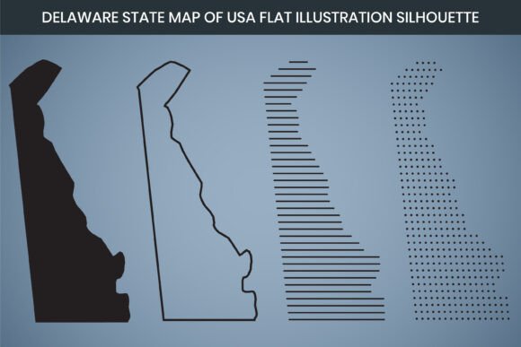
When you think of a map, you probably imagine crisp lines, perfect geometry, and satellite precision. Yet there is a growing appreciation for the organic, human touch that hand-drawn aesthetics bring to design. The Delaware State Hand Drawn Outline Map US captures precisely that charm—a thoughtfully crafted representation of Delaware’s boundaries that feels personal, approachable, and visually distinct. Whether you’re creating classroom materials, apparel graphics, or business branding, a hand-drawn state silhouette can transform a basic outline into a storytelling element. This Delaware outline map is provided as a high-resolution digital download that combines artistic warmth with practical usability.
Unlike generic clip art or overly rigid vector templates, the Delaware State Hand Drawn Outline Map of USA emphasizes texture and character. Each line carries the subtle imperfections that make hand-drawn imagery feel more human and relatable. These qualities make it particularly effective for projects where you want to evoke craftsmanship, heritage, or a local, small-batch feel. The resource comes ready to use in a variety of software, making it accessible even if you’re not a professional designer. In the following sections, we’ll explore what this map includes, how it can be applied, and what makes it a versatile asset for both creative and professional projects.
What the Hand-Drawn Delaware Outline Map Includes
At its core, this is a silhouette map of the state of Delaware, presented in a hand-drawn style rather than a sterile, computer-generated path. The file package is comprehensive and designed to work across different platforms. When you obtain this digital map, you receive:
- An Adobe Illustrator (.AI) file, fully editable for professional vector work.
- Scalable Vector Graphics (.SVG) for web use or integration into websites and apps.
- Encapsulated PostScript (.EPS) for cross-software compatibility.
- DXF format, which supports laser cut design and CNC routing workflows.
- A print-ready PDF, already set up at the correct dimensions and quality.
- High-resolution PNG files at 3000 x 2000 pixel dimension and 300 DPI resolution.
Each file is created in RGB color mode, which is standard for digital screens and many print-on-demand services. However, because the outlines are vector-based, colors can be easily adjusted to CMYK if needed for offset printing. The claim of being “fully editable” extends to text layers in Canva, where you can load the PDF or PNG and modify elements directly within that popular online design tool. This means you don’t need expensive software to make simple customizations. Whether you’re adding a title, changing the line weight, or overlaying the map on a photograph, the flexibility is built into the product.
Who Finds This Delaware Map Most Useful?
The Delaware State Hand Drawn Outline Map of USA is not a one-size-fits-all asset, but its appeal spans a surprisingly wide range of users. Teachers and educators often search for educational Delaware maps that students can color, label, or use in state history projects. The hand-drawn quality softens the experience, making it feel less like a test and more like a creative exercise. Graphic designers appreciate the minimalist Delaware map as a base element for logos, event invitations, and posters that require a local touch. Because the outline is clean yet organic, it can be incorporated into both modern and vintage-themed layouts.
Small business owners—especially those based in Delaware—find the flat Delaware map useful for store signage, loyalty cards, or packaging that emphasizes a local identity. Crafters and DIY enthusiasts value the DXF format for laser cut design, transforming the silhouette into wood signs, acrylic ornaments, or even metal art. Nonprofit organizations and community groups can use the printable Delaware map for fundraising materials, flyers, and event maps without worrying about image resolution. Essentially, if your project needs to say “Delaware” in a visual way that feels deliberate and well-crafted, this outline map delivers.
Creative Applications Across Different Fields
The versatility of a hand-drawn state outline extends far beyond putting it on a flyer. Consider a few real-world scenarios where a Delaware vector like this becomes a practical tool:
- Apparel and merchandise: A screen printer uses the EPS file to create a simple, elegant Delaware tee for a local marathon. The hand-drawn lines soften the graphic, making it feel like a commemorative illustration.
- Wedding and event stationery: A designer incorporates the Delaware silhouette into a save-the-date card for a couple moving to or from the state. The outline is filled with a subtle watercolor texture, printed at the recommended 300 DPI for sharp results.
- Educational worksheets: A fifth-grade teacher prints the Delaware printable PDF for 25 students, asking them to mark the capital, major rivers, and neighboring states. The hand-drawn look sparks more engagement than a textbook map.
- Marketing infographics: A business creates an infographic showing distribution centers across the East Coast. The infographic map of Delaware, while small, is instantly recognizable and breaks up data with a human touch.
- Woodworking and crafts: Using the DXF file, a hobbyist loads the design into a laser cutter and produces a detailed wooden wall art piece of the Delaware state boundaries, complete with a slight engraving effect that mimics the hand-drawn line.
These examples illustrate that the map isn’t just a sketch; it’s a resource that bridges digital and physical creation. The combination of Delaware map design formats means you can move seamlessly from screen to print to fabrication tool with minimal conversion hassle.
Technical Strengths That Support Practical Use
Understanding the numbers behind a digital asset helps you avoid disappointment. The 3000 x 2000 pixel dimension at 300 DPI resolution means the PNG file will print with crisp clarity up to roughly 10 by 6.7 inches without any loss of quality. That’s large enough for most flyers, magazine pages, or framed prints. For larger displays, the vector formats (AI, SVG, EPS) are infinitely scalable, so you can blow the outline up to billboard size and still retain razor-sharp edges.
The inclusion of RGB color mode is standard for digital use, but because vector files separate line art from background, you can easily redefine the color space. If you need a pure black line with no background, the PNG’s transparency (depending on the specific file setup) or the vector paths will accommodate that. The “fully editable file” descriptor is meaningful: you can adjust the stroke style, add your own embellishments, or even combine it with other state outlines to create a United States map series. The Canva editable option lowers the barrier for non-designers, allowing team members to add text, change colors, or resize the map directly in a browser.
Considering the Hand-Drawn Style: Benefits and Boundaries
No design choice exists in a vacuum, and a hand-drawn outline map carries both advantages and considerations. The primary benefit is its distinctive personality. A flat illustration map that’s perfectly smoothed might go unnoticed, but one with slight irregularities draws the eye and communicates intention. It says, “Someone spent time on this.” In branding, that can translate to perceived quality and authenticity.
At the same time, a Delaware State Hand Drawn Outline Map US might not suit every purpose. If you require a map with exact latitudinal and longitudinal accuracy for navigational use, this is not the product. Hand-drawn outlines are interpretive rather than survey-grade. They may not include intricate coastal details such as every inlet or marsh. This map is about the recognizable state shape of Delaware—the distinctive curved northern border and the clean eastern shoreline—rendered with an artistic sensibility. For most graphical needs, that is more than sufficient. For technical mapping, you would look elsewhere. Recognizing this limitation helps you choose the right tool for the job.
How to Evaluate Suitability for Your Project
Before downloading and incorporating the map, ask yourself a few questions. What is the final output? If you need a file that goes directly to a print shop, the print-ready PDF and high-res PNG will likely meet the requirements. If you need to cut or engrave material, confirm that your laser or CNC software accepts DXF files and test a small portion first. If you plan to edit extensively, the AI or SVG files give you node-level control.
Next, consider the stylistic fit. Pair the Delaware state outline with fonts and textures that match the hand-drawn vibe—slab serifs, earthy colors, or even a vintage paper background. Contrasting a rough, organic outline with ultra-sleek modern graphics can also be striking, but it requires careful design harmony. Think about the audience: a minimalist Delaware map might resonate with a boutique’s customers, while a school project might call for something more playful that children can interact with. The file package is flexible enough to accommodate both, provided you’re comfortable making basic adjustments in a vector editor.
Licensing is another practical point. While the product description states “fully editable file,” you should always check the terms regarding resale, redistribution, or use in trademarked goods. In most cases, using the Delaware State Hand Drawn Outline Map of USA for personal projects, client work, and physical products for sale is allowed, but passing the raw digital file along as-is typically isn’t. Understanding these boundaries ensures you respect the creator’s work while maximizing your own project’s potential.
Bringing It All Together: Value Beyond the Pixel
There’s a quiet confidence in using a graphic element that avoids the generic. The Delaware State Hand Drawn Outline Map US is not simply a shape; it’s a carefully crafted representation of a place people call home. It carries an educational angle—helping students visualize geography—and a commercial angle—giving brands a region-specific visual anchor. Because it arrives in multiple file formats, including AI, SVG, EPS, DXF, PNG, and PDF, it caters to professionals and beginners alike. The high resolution and print-ready setup mean you spend less time troubleshooting and more time creating.
Whether you’re designing a flat Delaware map for an infographic, routing a laser cut design piece, or preparing a classroom handout, this digital map package steps out of the way and lets your creative goals take center stage. It’s a reminder that sometimes the simplest elements—an outline, a silhouette—can carry the most meaning when they’re done with care. By understanding what this map offers, how it behaves across different software, and where it fits best, you equip yourself to make informed design choices that serve your project and your audience well.