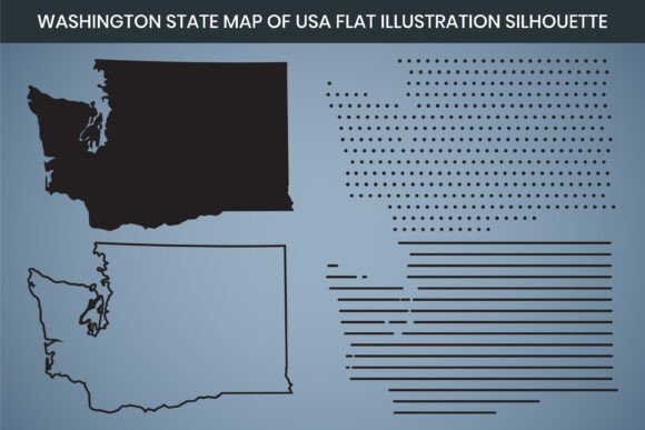
Washington State Hand Drawn Outline Map
There’s something honest about a hand-drawn line. When that line traces the familiar contours of Washington state—the jagged coastline, the straight Columbia River boundary, the curve around Puget Sound—it becomes more than a map. The Washington State Hand Drawn Outline Map is a digital design asset built for real projects, not just a generic silhouette pulled from a search engine. It arrives as a fully editable, multi-format file bundle timed for creative workflows: 3000 x 2000 pixel dimensions, a crisp 300 DPI resolution, RGB color mode, and a design already prepped for laser cutting. Whether you download the AI, SVG, EPS, DXF, PNG, or PDF file, you’re holding something practical enough to move from screen to finished piece without extra tracing or cleanup.
Where and When a Hand Drawn Outline Moves Ideas Forward
Standard vector maps get the job done, but they can feel cold. The hand-drawn character of this Washington outline naturally fits moments where personality matters more than precision engineering. Think about the last time you planned a rustic wedding in the Methow Valley. A save-the-date card with a stiff, satellite-style map might clash with the mason jars and wildflowers. A gently sketched Washington silhouette, though, echoes the feel of a hand-lettered invitation. That’s one scenario. The same file shows up in a high school classroom when a teacher needs a clean, printable Washington map for a geography unit. They pull the 300 DPI PDF, print thirty copies, and the outlines don’t turn into pixelated blobs on the paper.
Timing matters too. Entrepreneurs launching a Washington-focused subscription box don’t want to spend hours cleaning up a low-quality PNG found online. A downloadable, print-ready outline map that’s already laser-cut compatible moves them straight to mockups. Or consider a blogger who, on a Tuesday evening, decides their hiking guide post needs a visual anchor. They upload the SVG to their design tool, change the stroke color to match their brand, and publish without waiting for a custom illustration. The file bundle’s variety means the map shows up exactly when and where it’s wanted—whether that’s a last-minute social graphic or a carefully planned product label.
Real-World Uses Across Creative, Educational, and Commercial Settings
Most people don’t need a map just to look at it. They need it to do something. Here’s how different hands put this Washington outline to work.
- Graphic designers pull the fully editable AI or EPS files into branding projects. A Washington brewery might want a state-shaped hop cone graphic. The hand-drawn outline gives the design a craft, small-batch feel without starting from scratch.
- Laser engravers and CNC hobbyists reach for the DXF file. It’s already set up for laser cut design, so they can cut wood, acrylic, or leather into wall art, keychains, or desk ornaments shaped like Washington. No node editing marathon.
- Educators and tutors use the printable PNG or PDF to create worksheets, coloring pages, or interactive notebooks. The 3000 x 2000 pixel size means even projecting it onto a whiteboard keeps the lines sharp enough for tracing or labeling activities.
- Small business owners who serve specific Washington regions—plumbers, florists, mobile dog groomers—add this map to their “service area” web page. They recolor the vector in Canva, drop markers on cities, and give customers a friendly, skimmable visual instead of a boring ZIP code list.
- Event planners incorporate the silhouette into invitation suites, welcome bags, or directional signage for bachelor parties doing a wine tour through Walla Walla. The hand-drawn line doesn’t compete with other design elements; it complements them.
- Crafters and scrapbookers use the SVG with cutting machines like Cricut or Silhouette. They cut vinyl decals from the map outline for car windows, laptop stickers, or memory book covers documenting a Pacific Northwest road trip.
- Infographic creators and data journalists sometimes need a minimal, recognizable Washington shape to anchor statistics. They import the editable file, apply color fills to regions, and build comparisons that feel more human than a sterile dashboard.
These uses aren’t theoretical. They happen because the file bundle meets users exactly where their software and skill level sit. A Canva beginner finds the same value as an Adobe Illustrator veteran.
Why Different Users Keep Returning to This Hand Drawn Map
A single file type forces people into a corner. This bundle deliberately avoids that. The Washington State Hand Drawn Outline Map includes AI, SVG, EPS, DXF, PNG, and PDF formats, which means a laser engraver isn’t stuck with a raster image, and a web designer isn’t forced to open Illustrator just to export a transparent PNG. The 3000 x 2000 pixel dimension at 300 DPI delivers a practical canvas: large enough to print at roughly 10 by 6.7 inches without scaling up, and even larger if you’re willing to drop DPI slightly for a banner or sign. The RGB color mode keeps screen colors vibrant, and conversion to CMYK for print is straightforward when needed.
Beyond technical specs, the hand-drawn quality transforms a plain state shape into a design element with warmth. Washington’s geography—the Olympic Peninsula, the islands, the angular eastern border—gains a subtle personality when rendered by a human-inspired stroke rather than a perfect geometric trace. For brands that lean into earthy, outdoorsy, or locally made identities, that slight imperfection is exactly right. It signals approachability. A tech startup’s annual report might still prefer a precise, sterile map, but a coffee roaster based in Spokane, a Seattle sustainable goods shop, or a Leavenworth bed-and-breakfast will find that this outline speaks their language.
The “fully editable” note isn’t a hollow label. In vector form, you can isolate the outline, change line weight, apply dashed strokes, fill the interior with a pattern, or break apart the shape for partial views. The Canva editable aspect opens those possibilities to people who don’t own or know professional design software. Someone running a PTA fundraiser can drag the map into a Canva template, type “You are here,” and have a flyer ready within their lunch break. That’s the real outcome: fewer barriers between an idea and a finished piece.
Things to Consider Before You Download and Use This Map
No digital file solves every problem automatically. Being thoughtful upfront prevents friction later. Here are a few practical things to weigh.
- Color mode and print specifics. The file comes in RGB, which is perfect for digital use. If you’re sending it to a commercial printer who requires CMYK, you’ll need to convert it. The conversion is simple in most design software, but colors can shift slightly. A test print or soft proof helps.
- Software compatibility. While the bundle covers a wide spectrum, not every tool handles every format elegantly. DXF files work well in CAD and LightBurn for lasers, but opening them in generic design software may produce unexpected results. Verify that your intended workflow—Cricut Design Space, Adobe Photoshop, Canva, or a specific engraver—accepts the format you plan to use.
- Editable vs. instant print. “Fully editable” refers to the vector files (AI, SVG, EPS) and the Canva-ready version. The PDF is print-ready, but editing paths in a basic PDF viewer isn’t possible. If you want to recolor or modify the shape, start with the vector formats or the Canva file.
- Laser cutting readiness. The DXF is designed for laser cut design, meaning the outlines are likely set up as continuous paths with appropriate node placement. Still, always review the file in your laser software for any necessary tweaks to cut order, power settings, or material thickness. No generic file anticipates your specific machine’s quirks.
- Intended style. The hand-drawn character is a strength in many contexts, but if your project requires a hyper-accurate, governmental-looking border with all islands perfectly rendered to satellite precision, this may feel too organic. Know the aesthetic you’re after.
- License and usage rights. Most such map products allow personal and commercial use within designs, but it’s wise to check the seller’s license terms. Can you use it on merchandise sold in unlimited quantities? Is there a restriction on reselling the unaltered file? Glancing at this now avoids headaches later.
When users keep these points in mind, the map integrates smoothly. It’s not about having a perfect universal file; it’s about matching the right format to the right task and acknowledging small adjustments that might be needed.
From a Digital Download to Something You Can Hold
Let’s walk through what actually happens. A woodworker in Bellingham buys the file set. They import the DXF into LightBurn, place it on a virtual workspace matching their maple board, and start the laser. Within minutes, they have a tactile Washington shape with slightly charred edges. They sand it, add a keyhole slot, and list it as a rustic state pride decor piece. The same day, a volunteer coordinator for a watershed restoration nonprofit downloads the PDF and prints posters to hang at community centers. The map’s clear outline helps residents visualize the region they’re protecting. Neither person talked to the other. Both extracted concrete value from the same download.
A travel blogger might open the SVG in Affinity Designer, make the fill transparent, and superimpose a dotted line tracing their recommended road trip from Seattle to the Palouse. That single graphic becomes the hero image of a blog post, pins well on Pinterest, and gets embedded in an email newsletter. A few weeks later, the same blogger pulls the file into Canva, adds county labels, and creates a printable packing guide for Tri-Cities wine tasting—same map, entirely different outcome.
These examples underscore a quiet truth: a well-prepared digital asset like this Washington State Hand Drawn Outline Map tends to live many lives. It’s not a one-and-done purchase. Once downloaded, the file stays in a folder, ready for the next project that needs a familiar shape rendered with an organic touch.
Why the Hand Drawn Quality Matters More Than You’d Guess
There’s a reason people still use hand-drawn letters on chalkboard menus even when laser-cut stencils exist. Imperfection communicates warmth. The same principle applies to map outlines. Washington’s silhouette, with its complex waterways and dramatic peninsula, can look stark or overly technical when reduced to a cold vector trace. A hand-drawn approach softens those edges—literally and figuratively—making the shape feel more like an illustration and less like a survey.
For businesses, this matters because consumers are bombarded with generic, stock-looking visuals. An estate sale company in Yakima that uses a hand-drawn Washington outline on their flyer signals that they care about their local identity without being corporate. A Seattle restaurant printing maps on their takeout bags to show the origin of ingredients from around the state benefits from the same human feel. In educational contexts, hand-drawn elements often engage students better; a worksheet with a slightly playful outline encourages coloring and labeling activities more than a sterile computer-generated boundary.
Making the Most of 3000 x 2000 Pixels at 300 DPI
These numbers aren’t just bullet points—they directly shape what you can produce. At 300 DPI, the embedded raster or print-ready PDF delivers sharp output at sizes up to 10 inches wide and about 6.67 inches tall. That fits a standard half-page flyer, a product label, or a middle-of-a-blog graphic nicely. Need a larger print, like an 18 x 12 inch sign? At that size, the effective DPI drops, but because the design is a silhouette (not a photo), the loss of sharpness remains visually acceptable, especially for casual viewing. For projects demanding pure scalability without resolution limits, the vector files (AI, SVG, EPS) have no pixels to worry about—you can scale to billboard size without degradation. The 3000 x 2000 pixel dimension serves as a generous starting point for raster-based workflows, giving more than enough data for screen displays and small-to-medium prints.
Fitting Into Today’s Go-To Platforms
Creators don’t live in one program anymore. Morning might mean a quick Canva edit for an Instagram Story. Afternoon could involve Adobe Illustrator for a merchandise design. Evening might mean uploading a DXF to a Glowforge. This bundle spans that reality. The Canva editable feature lower the barrier for people who never learned vector editing. The PNG gives a familiar, drag-and-drop image file that works everywhere from Google Docs to PowerPoint. Laser cut design readiness in DXF format addresses a specific, growing hobbyist and small manufacturing need: custom home decor, signage, and personalized gifts shaped like Washington state are surprisingly popular sellers on platforms like Etsy.
What ties it together is fewer interruptions. You don’t need to convert a low-quality JPEG into an SVG, fight with auto-trace tools, or redraw a map boundary from reference images. The outline is already a clean, closed path where it needs to be. That means more time spent on what makes your project unique—adding text, layering photos, selecting materials—and less time fixing someone else’s mediocre design.
In practice, the Washington State Hand Drawn Outline Map becomes a quiet workhorse. It doesn’t demand attention. It simply shows up in the right format, at the right resolution, and with enough flexibility to become whatever the next idea requires.